| View this page at 1024x768
Contact Webmaster
This page last updated Feb 2009.
The 'SHAME AT BODANGORA' section of this website has been removed. It was proving counter-productive to some recently renewed efforts by several people who are collecting information important to the history of Bodangora - which has always been the aim of this website.
Preservation of the heritage of Bodangora has apparently never been vested with any authority other than the Wellington Shire Council. They must therefore accept responsibility for any neglect of this duty.
Just posted March 2008! SNOW at Bodangora 1930
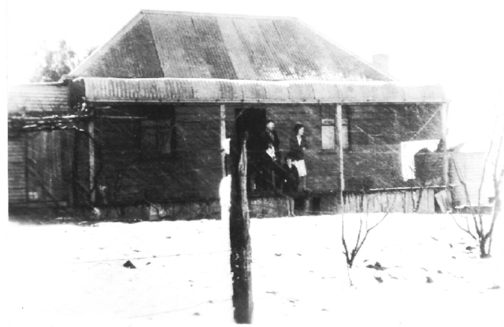
Also a photo of the Tonkin family taken in 1935 HERE
Photos and information thanks to Darrell England
Checkout the new locations page to see where the Tonkins lived (31).
If you have any old house or family photos - send them in!
Can you help with any information or pics on old hotels ANYWHERE in the Wellington district?
Contact Barbara Preston
Barbara is a Wellington historian whose family has roots at Bodangora. She is helping with the construction of this website with expert advice & has supplied many of the old images.
This website was inspired by Steven Ball who attended the school in the early 1960's. You can contact him for any discussion or if you can help with extra information.
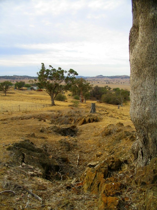
McGregor's 'white flint' ridge was probably close to this area just north of the chimney
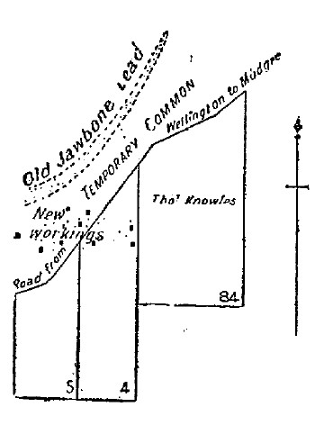
Map drawn in 1900 showing the old Jawbone alluvial field. The northern end of the workings are still visible on the Bodangora Common.
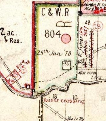
The site of the Kaiser settlement. Portion 53 near the centre was owned by the 'Council for Education' and was the site of the original public school known as Mitchell's Creek.
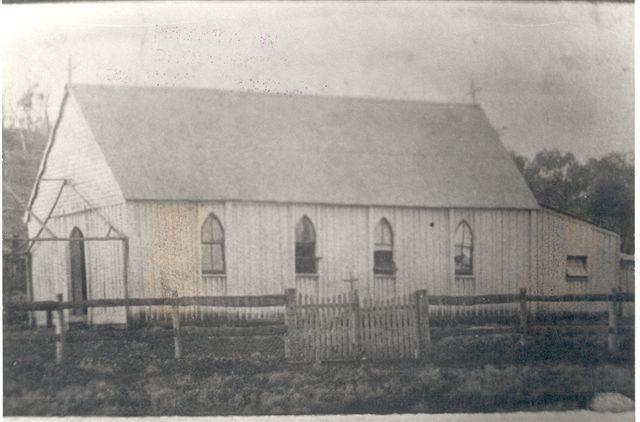
The convent at Kaiser - est 1877.
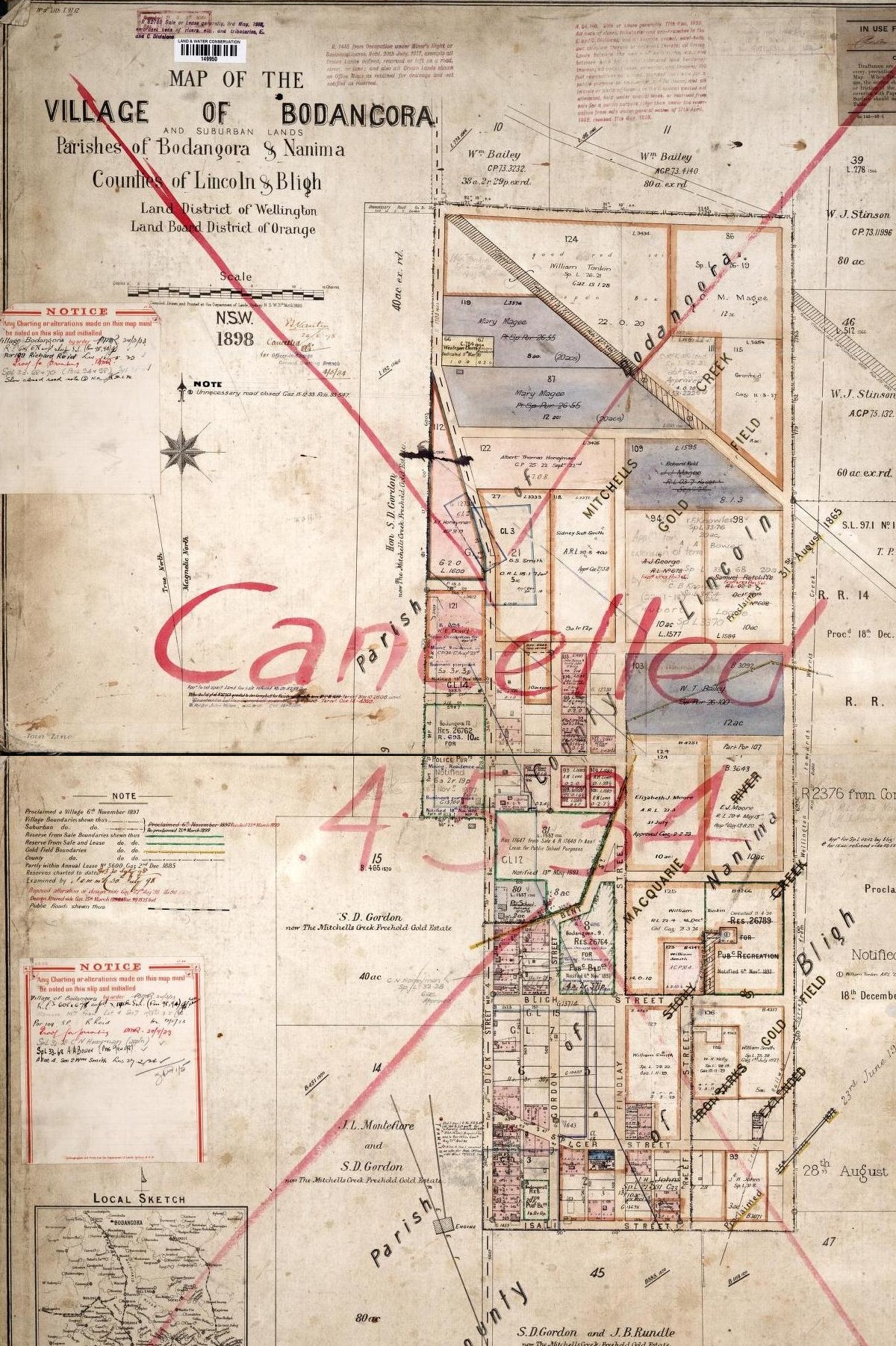
Village of Bodangora 1898
|
Bodangora
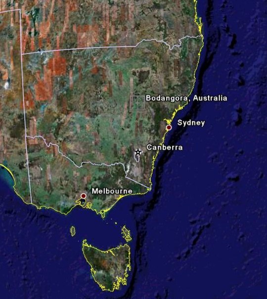
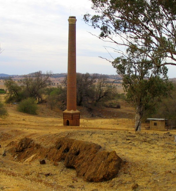
--Image from Google Earth-------------------Old chimney stack 2006

The remnants of Bodangora township from the east 2006. Note the chimney stack on horizon just right of centre of pic.
A Brief History
First Settlement of the District & Before
The Wellington district was long the domain of the Wiradjuri Aboriginal people, whose land consisted of a large portion of central western NSW. The first European reputed to visit the district was John Oxley in 1817, but it is also noted that he found the remains of a hut & cattle foot prints on this trip. The first European settlement in the Wellington area was established in 1823 by Lieutenant Percy Simpson, and consisted of convicts and soldiers. In 1824 the first property, later to be called 'Gobolion', was established about 5km to the north of the present town.
In 1834 an Englishman, Joseph Montefiore, was granted 2,560 acres near 'Gobolion', and during the later part of the 1830's, through extra grants and purchases, his estate had grown to in excess of 10,000 acres. In 1840 he subdivided the western part of this estate, and the township of Montefiores was established. This 'Nanima' estate had a substantial frontage to the Macquarie River and included the area around Mitchell's Creek, later to be known as Bodangora.
Discovery of Gold about 1839
As early as 1839, a shepherd named McGregor, who worked on this 'Nanima' estate from his hut near Mitchell's Creek, is reputed to have collected gold from a 'white flint' ridge on his run. The following is from an article in the
Bathurst Free Press, dated April 20th 1856
'Although the existence of gold in NSW was known for many years past to a few scientific men, yet it is generally admitted that McGregor was the first person who found it in renumerative quantities.- - -
McGregor, now a wealthy man, was formerly a shepherd in Mr. Montefiores establishment at Wellington. His flock fed over lands situated on Mitchell's Creek, and possessing a geological turn of mind, and from the nature of his occupation, abundant leisure to prosecute research he was led to break up and examine portions of a quartz ridge which traversed the sheep run. During the investigation he met with a metal (amongst several others) which he supposed to be gold and forwarded a sample of it to Sydney. The result proved the correctness of his opinion and thenceforth he devoted the whole of his available time to the accumulation of this precious metal'.
The existence of McGregor's secret reef finally became public knowledge after Hargraves made his 'discovery' at Summer Hill Creek in 1851, leading to gold fever in the Wellington district. There may have been some early easy pickings from the quartz reef near Mitchell's Ck., but capital expenditure was needed to establish a mine to further work this reef gold, so the area was overlooked in favour of other alluvial areas (such as Burrendong) until the establishment of the Mitchell's Creek Mining Co. in 1869. Further gold discoveries were made at Kaiser, 3 miles to the north, and an alluvial field a short distance to the south known as Jawbone, whose gold had almost certainly originated from quartz reef at the Mitchell's Creek site.
Settlements at Lincoln, Kaiser & Jawbone
The gold prospectors were also joined by settlers who took up selections in the district. The increase in traffic on the main road leading from Wellington to Mudgee led to a small settlement at the Mitchell's Ck. crossing known as Lincoln. In 1873 the 'Mitchell's Creek Hotel' at Lincoln advertised 'Wines, Ales & Spirits of very best brands. Good Stabling. Paddocks free for travelling stock'. This increase in traffic as well as the discovery of alluvial gold led also to the establishment of a settlement at Jawbone, also on the main road several miles closer to Wellington. The 'Waterloo Hotel' at Jawbone, advertised in 1873 'First-class accommodation for travellers'. A small settlement also formed on the northern bank of Mitchell's Creek near the crossing adjacent to the present day 'Glen Mitchell' homestead, several miles downstream from the crossing at Lincoln, and became known as Kaiser Crossing. This settlement also had a public house as well as a church, convent and numerous residences (and eventually a public school). A crushing plant was also established here in close proximity to water, the ore being transported from the nearby Kaiser mine for treatment. Crushing from the plant are still visible, evidenced by their differing colour to the surrounding dirt, as are remains of the old Kaiser mine workings. This settlement became known as Kaiser, and the settlement, being the main one in the area, serviced not only the mine workers, but the rapidly growing number of settlers taking up selections in the area. The following is an excerpt from an article referring to the establishment of the Convent at Kaiser in 1877.
'The Departure of Nuns from Bodangora - April 1925'
'The conditions they had to face were austere enough even for a hermit. Low living and high thinking were the order of the day. Fasting and abstinence outside the Church's prescription often came their way. The country around was quite different from what it is now. There was no road beyond a bush track, between Bodangora and Wellington. It was a lonely ride all the way through unfenced thick-timbered country, still sacred, with little interruption to the dingo and bandicoot, and when you came to Wellington you had a town before you small enough to be called a village without reasonable offence'.

Looking towards the site of the Kaiser settlement in 2006. The settlement was along the base of the hill - the 'Glen Mitchell' homestead is just visible at left and is near the Mitchell's Ck. crossing.
A New Settlement Adjacent to 'The Mitchell's Creek Freehold Gold Estate'
The gold/copper mine at Kaiser, despite considerable promise and investment, failed to continue operating profitably into the 1880's, and the alluvial deposits at Jawbone proved patchy, providing negligible gold during this time, so the nearby Mitchell's Creek reef deposit, became established as the main mine in the district. A settlement began forming adjacent to the mine workings, and as early as 1890 a new general store became a P.O. Receiving Office known as Mitchell's Creek - a contractor bringing a mailbag from nearby Lincoln, on the main Wellington - Mudgee road, twice weekly. Inevitably people drifted from Kaiser & Jawbone to the new settlement, which, due to objections about the name 'Mitchell's Creek' (as follows) -
'As 'Mitchell's Creek' applies to a very large area it has been suggested that a more distinctive name should be given to the Mitchell's Creek P.O. so that correspondence for other parts may not be sent to that office and delayed'.
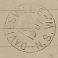
became known as 'Daviesville', after the mine manager, Mr Davies suggested if the name is to be changed he would like it called 'Daviesville' - the name change becoming effective in Nov 1892.
As the mine prospered, and the number of employees grew, so did the adjacent settlement. By December 1896 Mr. Davies was no longer involved with the mine, and the proprietors of 'The Mitchell's Creek Freehold Gold Estate', Jas. Dick, T.M. Dalveen & J.M. Findlay, applied to the Postmaster General of NSW to have the name of the P.O. changed to Bodangora.
'Adverting to the visits the partners made to you several times on the subject of the name of the township, we would be very glad if you could cause it to be altered from the beginning of the year to - BODANGORA - which is an appropriate local name &, not at present the name of any other Post-office. Part of this property lies in Bodangora parish, while Mt. Bodangora is the most conspicuous hill in the neighbourhood, and directly overlooks the township. There is no town of a like name, & the Owners of this Estate have lately had a private township surveyed surrounding the Post-office (officially known as Daviesville), & intend to register this township with the Title Deeds office as Bodangora. It would be desirable therefore to name the Post-office accordingly'. J.M. Findlay
Despite protests from some adjoining areas such as 'Bodangora Station', who received their mail via the Comobella office, (and another from a Wm. Smith at Comobella who suggested the name 'Wilaganalgie' - the native name for Daviesville), the P.O. name was apparently changed to Bodangora in early 1897, and the village proclaimed in November 1897.
|
 View my Guestbook


